Stretching from St David’s, Pembrokeshire, to southwest Scotland, this region includes waters from England, Wales, Northern Ireland and Scotland and the Isle of Man. There are now 10 MCZs in this region helping to protect marine wildlife and habitats.
Existing Marine Conservation Zones
There have been 10 Marine Conservation Zones designated in the English waters of the Irish Sea so far, including the honeycomb worm reefs of Allonby Bay, Cumbria, and the subtidal sands of Fylde, off the Lancashire Coast.
Fylde
This site was designated in 2013 to protect the subtidal sand habitats found in the area. Fylde overlaps the Liverpool Bay Special Protection Area, which was designated to protect birds such as the red-throated diver and common scoter. The alliance will not only protect the birds, but the MCZ designation will protect their food source as well.
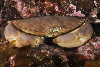
Flatfish, rays, gurnard, swimming crabs, hermit crabs and other crustaceans feed on the bivalves (‘two shells’ such as cockles and mussels), making this region not only full of amazing creatures but also of great value to the fishing industry. If maintained, this MCZ could provide a healthy population of species to spill over into other parts of the coastal waters.
A rich area for marine wildlife where species such as sand eels and bivalve molluscs provide food for other important species. The diversity of these waters not only attracts other species to feed, and us to fish, but also recreational activities such as diving and sailing which are popular here.

Contains UKHO Law of the Sea data. Crown copyright and database right and contains Ordnance Survey Data Crown copyright and database 2012
Cumbria Coast
The Cumbria Coast was designated as a Marine Conservation Zone in 2013 to protect a wide range of habitats found within the site, including honeycomb worm reefs and rock habtiats.
The rocky scar that is St Bees Head provides a unique habitat in the north-west, hosting a variety of fascinating species. This MCZ will help to protect the headland’s biodiversity and retain the character that makes it so special.
The sandy seafloor off the Cumbria Coast has rich communities of burrowing animals and provides a feeding ground to the 10,000 pairs of breeding seabirds nesting at St Bees Head, including England’s only breeding colony of back guillemots at Fleswick Bay.

Contains UKHO Law of the Sea data. Crown copyright and database right and contains Ordnance Survey Data Crown copyright and database 2012
West of Walney
West of Walney is located just off the coast of Walney Island, Cumbria, and covers two different habitat types: mud to the north and sand to the south.
Mud and sand are both brilliant habitats for wildlife and full of life. High densities of burrowing brittlestars colonise the surface of the sandy areas, while urchins, worms and molluscs enjoy the mud alongside the commercially important Dublin Bay prawn (also known as the pub grub favourite, scampi).
Strange-looking spoon worms can also be found here. These bizarre creatures extend their long, green, spoon-shaped tongues out of their burrows in the mud to feed. Delicate sea pens also live on the West of Walney mud; their numbers are in decline and protection will help them to thrive once more. Who would have thought muddy habitats could be so full of life!

Contains UKHO Law of the Sea data. Crown copyright and database right and contains Ordnance Survey Data Crown copyright and database 2012
Allonby Bay
Allonby Bay hugs the coast into the Solway Firth and includes two extremely important areas for marine life, Dubmill Scar and Maryport Roads. The area is highly diverse containing many different species of sponge, soft coral, seaweed, sea squirt, anemone and the reef-building honeycomb worms which is at its most northern extent. The region is home to creatures such as the breadcrumb sponge and baked bean sea squirt. Now all we need is a bacon barnacle and we have a full fry-up!
Honeycomb worm (Sabellaria alveolata) reefs are a key feature of the northwest coastline. Millions of these worms form tubes from tiny grains of sand and shell, growing side-by-side to form a living reef. These reefs play a vital role as a home to other species, allowing settlement in areas which would otherwise be shifting sediments. Allonby Bay contains some of the best examples of reef in the North West. Let’s make sure we protect it for the future!

Contains UKHO Law of the Sea data. Crown copyright and database right and contains Ordnance Survey Data Crown copyright and database 2012
South Rigg (newly designated)
Located between the Isle of Man and Northern Ireland, South Rigg is extremely important due to the presence of the Irish Sea Mounds. These rocky outcrops on the sea floor provide a solid base for creatures to settle. There is a myriad of species that call this area home including anemones, brittlestars, sea firs and sea mats, tube worms, slender sea pens, heart urchins, mud shrimps and Dublin Bay prawns.
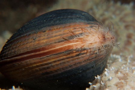
South Rigg contains the only known breeding population of ocean quahog clams in the Irish Sea. Did you know ocean quahogs can live for over 500 years, making them the longest lived animals in the world. They are used in scientific studies on climate change and are also an important food source for cod, but are not protected anywhere else in the Irish Sea.
Special features of South Rigg:
- The complex of rocky outcrops on the seafloor create a home for anemones, sea firs and sea mats
- Muddy habitats support huge biodiversity, from burrowing sea urchins and sea pens to commercially important Dublin Bay prawns
- Live juveniles of the ocean quahog have been recorded here, making it the only known breeding population in the Irish Sea area
- Basking sharks and foraging seabirds have been recorded in the area
Protection of South Rigg means:
- Preserving a rare habitat type in the Irish Sea; the rocky seabed and muddy habitats
- Safeguarding the ocean quahog population, allowing them to breed and recover without disturbance from trawling
- Ensuring connectivity between protected habitats in the Irish Sea
Natural England and the Joint Nature Conservation Committee have also identified this site as being at risk of damage and degradation, in particular to the mud habitats found within the site.

Contains UKHO Law of the Sea data. Crown copyright and database right and contains Ordnance Survey Data Crown copyright and database 2012

Ocean quahog ©arransealifeco.uk
Solway Firth (newly designated)
The Solway Firth is a shallow, wide estuary that provides a corridor between England and Scotland. The sand banks provide resting places for seals and the fast flowing waters are home to many species of fish that are not only of importance to us, but also create a rich feeding ground for seabirds.
This site is being recommended to protect smelt, a species of conservation importance. It is also an important nursery ground for bass, pollack and
some flatfish species.
The Solway Firth is an important area for conservation and is already designated as a Special Area of Conservation and Area of Outstanding Natural Beauty. Each type of designation protects different features of the area and, with the Marine Conservation Zone, will complement each other for maximum protection for the habitat and the species that live there.

Contains UKHO Law of the Sea data. Crown copyright and database right and contains Ordnance Survey Data Crown copyright and database 2012

Pollack ©Paul Naylor www.marinephoto.co.uk
Ribble Estuary (newly designated)
The Ribble Estuary is a fascinating place. The site is made up of an estuary that results in saltmarsh where river meets sea. This habitat is important countrywide as it provides a nursery ground for fish to mature and reach a size that will improve their chances of reaching breeding age. Saltmarsh is formed by grasses and plants that are highly tolerant of salt and can thrive even when they are often submerged by the tide.
The feature of conservation importance found in this MCZ is smelt - a small fish species essential to the local food web.
The Ribble estuary also provides a huge extent of sand flats that are essential to the survival of overwintering birds that rest and feed here during the winter months, before returning to the colder extremes of the North. They feed on the millions of small creatures at home in the sand, from tiny snails and worms to shellfish and crabs.

Contains UKHO Law of the Sea data. Crown copyright and database right and contains Ordnance Survey Data Crown copyright and database 2012

Knot ©Chris Gomersall/2020VISION
Wyre-Lune (newly designated)
The area is made up of two estuaries that result in saltmarsh where river meets sea. Saltmarsh is formed by grasses and plants that are highly tolerant of salt and can thrive even when they are often submerged by the tide. Estuaries are valuable feeding grounds for wading birds like ringed plover.
This habitat is important as it provides a nursery ground for fish to mature and improve their chances of reaching breeding age. Without shelter, breeding is less successful as juveniles contend with the harsh reality of living in the open water. Species of both commercial and conservation importance, including smelt, are present here, and are vital for seabirds to feed on.
The Lune is currently protected by the Morecambe Bay Special Area of Conservation and the Wyre is a Site of Special Scientific Interest. The addition of a Marine Conservation Zone will complement these designations and provide much needed protection for smelt.
This site was put forward to protect the smelt found within it. Smelt is not currently protected within any MCZs in the Irish Sea. Smelt has shown a marked decline within the UK and the Government has international responsibility to protect the species.

Contains UKHO Law of the Sea data. Crown copyright and database right and contains Ordnance Survey Data Crown copyright and database 2012

Ringed Plover ©Tom Marshall
Queenie Corner (newly designated)
The fine mud found here predominantly supports sea-pen (feather-shaped colonial animals) and burrowing megafauna communities. On the surface of the mud, crabs and starfish hunt and scavenge, while brittlestars, worms, and bivalves (animals with paired, hinged shells) live within it. The burrowing animals that make their homes here include the Norway lobster (Nephrops), mud shrimps, and a fish called the Fries’ goby, and their burrow networks provide shelter for many small animals.
This site is a substantial addition to subtidal mud habitats the marine protected area network in the Irish Sea, while contributing an example of deeper, offshore mud communities. The Nephrops (sometimes known as scampi/langoustine) found here is a commercially important species.

Scampi ©Paul Naylor www.marinephoto.co.uk/
West of Copeland (newly designated)
This 158 km2 offshore MCZ is located in the eastern Irish Sea.
The seabed here ranges from fine sand to mixed and coarse sediment, providing a home for a variety of animals such as anemones, sea urchins, bivalves (animals with paired, hinged shells), starfish, and bryozoans (“moss animals”). The site is especially important for the protection of subtidal coarse sediment habitats and the communities supported by them, particularly in deep water.

Sea mouse ©Paul Naylor www.marinephoto.co.uk
Welsh Offshore Sites
There are three potential sites in Welsh offshore waters within this region that were identified as suitable potential Marine Conservation Zones. Currently, the Welsh Government is developing options to fill gaps in the UK-wide network of Marine Protected Areas.
North of Celtic Deep
North of Celtic Deep is the most southerly recommended MCZ in the Irish Sea. It borders the territorial waters of the Republic of Ireland.
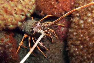
The deep water sediments in this zone support richly diverse and abundant populations of marine invertebrates. Worms, clams and crustaceans such as lobsters are present in large numbers and in turn provide food for fish populations.
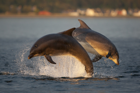
The North of Celtic Deep area is recognised as important for foraging seabird species such as the gannet, Manx shearwater, fulmar, guillemot and the charismatic puffin. Protection of such foraging sites will aid healthy, flourishing breeding seabird colonies on the Welsh coastline. North of Celtic Deep is also a feeding ground for passing whales and dolphins.
This site is now on hold in light of developments in the devolution of UK waters. We will continue to reinforce the need for an ecologically coherent network of Marine Protected Areas across the UK, which includes the need for sites to be designated in Welsh Offshore waters.

Contains UKHO Law of the Sea data. Crown copyright and database right and contains Ordnance Survey Data Crown copyright and database 2012
Mid St George's Channel
Seasonal thermal fronts in the Mid St George’s Channel increase phytoplankton productivity which makes the channel an important area for wildlife.
The seabed is largely sand and gravel creating an environment that allows annelid worms, clams and crustaceans to thrive. Sea firs, anemones and sponges are just some of the delicate creatures that are also found here amongst the cobbles.
All these species form an important part of the biodiversity of the region, encouraging other species to frequent the area which is an important feeding ground for passing whales and dolphins.
Special features of Mid St George's Channel:
- The diverse marine life found here is an important part of the biodiversity of the Irish Sea as a whole
- Seasonal thermal fronts make this an important feeding ground for breeding seabirds and for passing whales and dolphins
- Important geological features including those formed through glaciation
Protection of Mid St George's Channel would:
- Offer protection to highly mobile whale and dolphin species which use this area to feed, if included in the designated features list
- Benefit the Irish Sea food web dynamics as well as increase environmental resilience
This site is now on hold in light of developments in the devolution of UK waters. We will continue to reinforce the need for an ecologically coherent network of Marine Protected Areas across the UK, which includes the need for sites to be designated in Welsh Offshore waters.

Contains UKHO Law of the Sea data. Crown copyright and database right and
contains Ordnance Survey Data Crown copyright and database 2012
North St George's Channel
North St George’s Channel recommended MCZ includes a variety of important habitats and is situated offshore of the Isle of Anglesey, North-West Wales..
The nature of the seabed here has been shaped by glacial and subterranean activity, forming glacial drumlins and carbonate slabs. The latter are formed by methane gas leaking from the seabed.
This site also hosts rocky habitats, mixed sediments, sands and gravels that create a range of habitats for over 500 different species to colonise. Sponges, hydroids, worms, crustaceans, brittle stars, sea urchins and sea squirts are just some of the species that have been recorded in the depths of this site.
Many of the features of this site are in need of recovery and as such they have been identified as important habitats for the UK to protect.
Special features of North St George's Channel:
- Drumlins are found here - an important geological feature which provide critical evidence for the contemporary glacial deposition processes
- Croker Carbonate slabs are formed by methane seeping through the seabed and support rich marine life including and sponges
- Sponges, hydroids, worms, crustaceans, brittle stars, sea urchins and sea squirts are just some of the species that have been recorded in the depths of this site
Protection of North St George's Channel would:
- Safeguard drumlins, a rare feature in the Irish Sea that do not currently receive any protection and which are important for research and education
- Conserve a variety of deep water seabed types which in turn support a wealth of marine diversity
This site is now on hold in light of developments in the devolution of UK waters. We will continue to reinforce the need for an ecologically coherent network of Marine Protected Areas across the UK, which includes the need for sites to be designated in Welsh Offshore waters.

Contains UKHO Law of the Sea data. Crown copyright and database right and contains Ordnance Survey Data Crown copyright and database 2012

Hermit crab ©Alexander Mustard/2020VISION


