The Western Channel includes waters from south of Dartmouth, stretching around Cornwall and encompassing the north coast waters of the south west until St David’s on the Welsh coast. There are now 31 MCZs designated to protect rare and vulnerable wildlife and habitats in this region.
Existing Marine Conservation Zones
There have been 19 Marine Conservation Zones designated in the Western Channel and Approaches so far, ranging from the reefs and rocky shores of Skerries Bank and Surrounds on the coast of Devon, to the deep sea bed and cold-water coral reefs of The Canyons, 330km off Land's End.
Skerries Bank and Surrounds
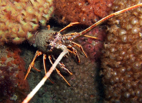
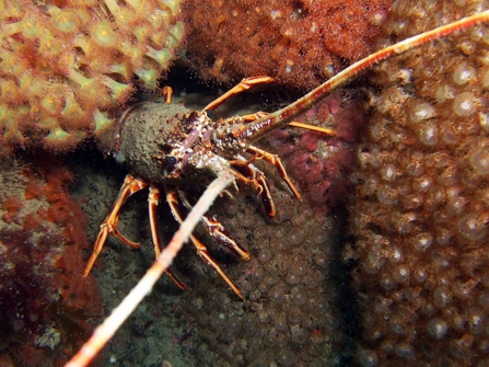
Skerries Bank and surrounds has been designated a Marine Conservation Zone for the wide range of habitats found in the area, as well as to protect the pink sea fan and spiny lobster.
The diversity of species found here is high. The Skerries Bank runs along the coast from Leek Cove to Torcross, and overlaps with the Start Point Inshore Potting Agreement (IPA). The IPA is a licensed area that is permanently or seasonally closed to mobile fishing gear (trawling), so that static gear, in particular pots, can be used instead.
Exposed rocky shores are dominated by barnacles and seaweeds interspersed with spiny lobsters, sponges and sea squirts. Slightly farther out, a dense kelp forest is important for red algae species. Within Start Bay, offshore muddy-sand and mud is characterised by molluscs, burrowing crustaceans, sea cucumbers and the burrowing worm Maxmuelleria lankesteri. The reef areas include delicate species like the yellow staghorn sponge, ross coral, pink sea fan, and sunset cup coral.
Overall it is an important breeding area for flat fish and other mobile species. The short-snouted seahorse has also been recorded at this site.
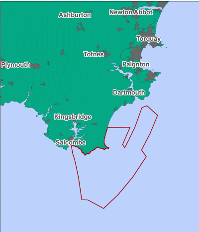
Contains UKHO Law of the Sea data. Crown copyright and database right andcontains Ordnance Survey Data Crown copyright and database 2012
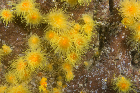
Sunset cup coral ©Paul Naylor www.marinephoto.co.uk
Tamar Estuary
The Tamar Estuary was designated in 2013 as a Marine Conservation Zone to protect the estuarine habitats and species found here, including intertidal biogenic reefs, blue mussel beds and smelt.
The Tamar Estuary stretches from the sea at Saltash and splits into two branches. The MCZ is made up of two areas; the upper Tamar and Tavy Estuaries and the upper Lynher Estuary. Both areas are home to saltmarsh and intertidal mudflats; mussel beds have been recorded on the intertidal mud in the Lynher, which provide a stable habitat for other estuarine species.
The estuaries are also the only known regional example for smelt, a species of conservation importance, which use the sites for breeding. The sites also provide a nursery for many other fish species.
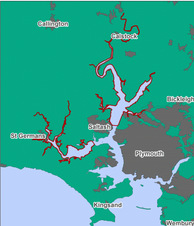
Contains UKHO Law of the Sea data. Crown copyright and database right and contains Ordnance Survey Data Crown copyright and database 2012
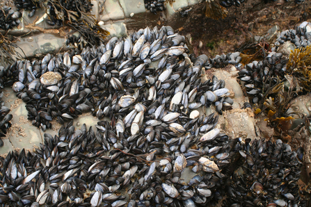
Mussels ©Julie Hatcher
Whitsand and Looe Bay
This site was designated as a Marine Conservation Zone in 2014 for a wide range of habitats, including rock and sand habitats and seagrass beds. It has also been designated to protect the pink sea-fan, ocean quahog, sea-fan anemone and stalked jellyfish found in the area.
Whitsand and Looe Bay Marine Conservation Zone is a large area stretching from Rame Head to Talland Bay, including Looe Island Marine Nature Reserve. The area has been recognised for its fantastic array of habitats. These include highly productive estuarine environments, seagrass beds, sheltered muddy environments and large subtidal sediment banks and reefs.
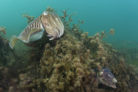
These diverse habitats support a wide range of species; pink sea fans, stalked jellyfish and cuttlefish can all be found in the bay, and commercially important fish species use Looe estuary as a nursery. The large scale of this area is also of specific importance, as a corridor of different marine habitats will be included within one marine conservation zone.
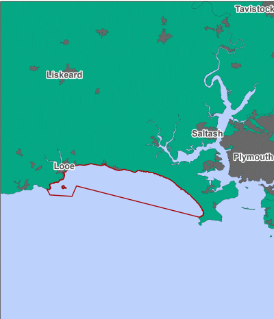
Contains UKHO Law of the Sea data. Crown copyright and database right and contains Ordnance Survey Data Crown copyright and database 2012
Upper Fowey and Pont Pill
This site was designated as a Marine Conservation Zone in 2014 to protect its estuarine habitats including saltmarshes, reedbeds and intertidal mud, offering rare habitats and species protection from damaging impacts such as water quality changes, physical damage and degradation.
The area includes the upper Fowey estuary and a tributary estuary flowing into the Fowey called Pont Pill. Extending all the way up to the Lostwithiel Bridge the site includes a wonderful saltmarsh habitat. The upper Fowey is particularly valuable as it is a rocky estuarine habitat which is rare in the South-West. The majority of estuaries in the region are fine mud and sand habitats. Estuaries are nutrient-rich habitats and provide food and shelter for many marine species. They also act as nursery grounds for young fish species.
Not only is the saltmarsh important for the nationally rare wasp spider and the short-winged conehead grasshopper, the estuarine area also forms a migration route for the endangered European eel into the river network, where it matures.
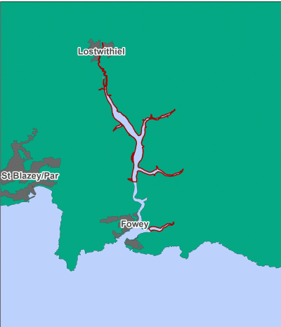
Contains UKHO Law of the Sea data. Crown copyright and database right and contains Ordnance Survey Data Crown copyright and database 2012
The Manacles
The Manacles was designated as a Marine Conservation Zone in 2013 for the wide range of habitats found in the area, as well as to protect the maerl beds, sea-fan anemone, spiny lobster and stalked jellyfish found here.
This is one of the most well know areas for rich marine biodiversity and productivity in Cornwall. Habitats range from rocky reefs to vertical rock faces with large cobbles and boulders grading into sandy sediment.
Its valuable rocky reef habitat is home to several important and well known species such as the pink sea fan, cup coral and beautiful jewel anemones. Commercially important species such as mackerel and bass are also found here. The diverse marine life make this area popular with divers.
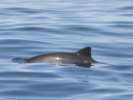
The Manacles is also widely recognised as an area with high harbour porpoise activity.
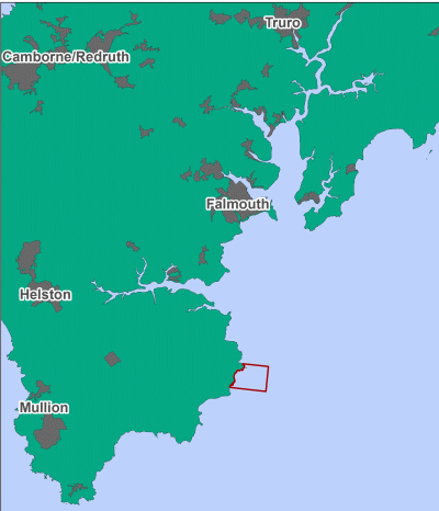
Contains UKHO Law of the Sea data. Crown copyright and database right and contains Ordnance Survey Data Crown copyright and database 2012
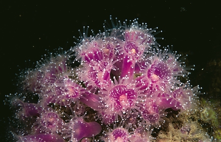
Jewel anemone ©Paul Naylor www.marinephoto.co.uk
Isles of Scilly Sites
This site was designated as a Marine Conservation Zone to protect a range of habitats found with the sites, including rock and sediment habitats, and to protect the spiny lobster and pink sea fan.
Although treated as a single recommended Marine Conservation Zone put forward by the Isles of Scilly Local Group, the area is actually made up of 11 individual zones around the Isles of Scilly.
Covering a wide range of habitats, the area varies in depth from sea level to approximately 70 metres deep. Rocky reefs provide habitat for species such as the spiny lobster, whilst diverse and extensive beds of seagrass provide valuable habitat for both the short-snouted and spiny seahorse.
Rare and fragile species are also found here including sunset cup corals and pink sea fans along with sponge, soft coral and anemone communities.
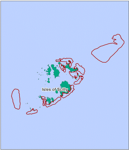
Contains UKHO Law of the Sea data. Crown copyright and database right and contains Ordnance Survey Data Crown copyright and database 2012
The Canyons
This site was designated a Marine Conservation Zone in 2013 in order to protect the deep sea bed and the only recorded living cold water coral reefs in English waters.
The Canyons is located about 330km south-west of Land’s End. The site is situated on the continental shelf break, with depths ranging from 200m in the east of the site to 2000m in the west. As its name suggests, the area includes two deep-water canyons, making this a more complex seabed than many other sites.
Along the edge of the continental shelf, at around 130 - 350m, there are large numbers of anemones, with hermit crabs dominating coarse grounds in shallower waters.
The shape of the seabed leads to an upwelling of nutrient-rich water, making the seas above highly productive, with higher than average sightings of seabirds and cetaceans.
You can see a video of this MCZ produced by the JNCC here.
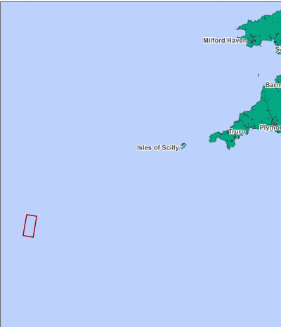
Contains UKHO Law of the Sea data. Crown copyright and database right and contains Ordnance Survey Data Crown copyright and database 2012
Cold-water coral ©DeepLinks Project - Plymouth University, Oxford University, JNCC, BGS
South-West Deeps (West)
This site was designated as a Marine Conservation Zone in 2013 to protect the sand and coarse sediment habitats found here, as well as for its relict sandbanks.
The South-West Deeps (West) is located along the south-western boundary of the UK continental shelf limit and is intersected by the geologically important Celtic Sea relict sandbanks.
This area contains a variety of habitats, including mixed sediments and sand important for burrowing species and animals using the seabed for camouflage to avoid predators. These habitats support a high diversity of plants and animals, such as anemones and hermit crabs, which in turn provide a rich foraging ground for seabirds during the summer.
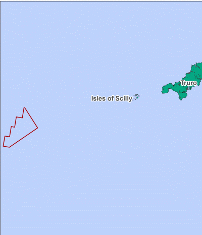
Contains UKHO Law of the Sea data. Crown copyright and database right and contains Ordnance Survey Data Crown copyright and database 2012
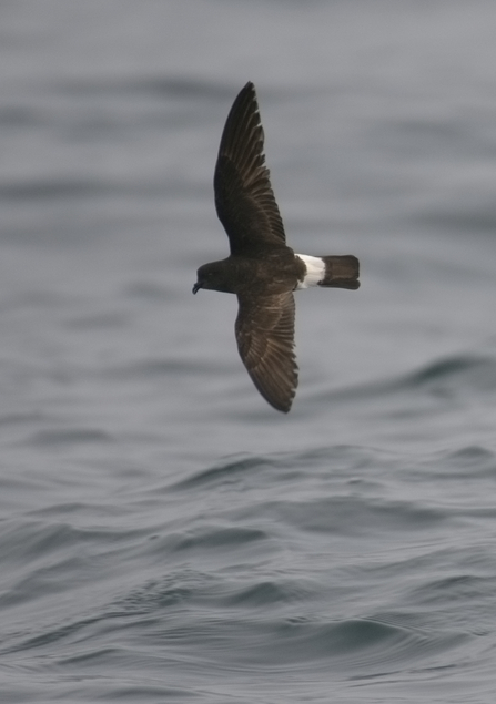
Storm petrel ©Chris Gomersall/2020VISION
East of Haig Fras
Situated in the Celtic Sea, off the north coast of Devon, the south-eastern corner of this area lies approximately 67km off the Land's End peninsula. This site has been designated for its rock, sand and gravel habitats.
This is an area of continental shelf; the seabed found here is made up of sand and coarse sediment, with most of the area ranging in depths between 50 - 100m.
These sand and gravel habitats support a range of species including the seven-armed starfish. This species can be recognised by its long arms and fringing spines, which it uses to bury itself in the sediment or to move quickly across the seabed to catch its prey. It’s not uncommon to spot common dolphins feeding in this area, and hermit crabs, anemones, octopus and cup corals can be found here.
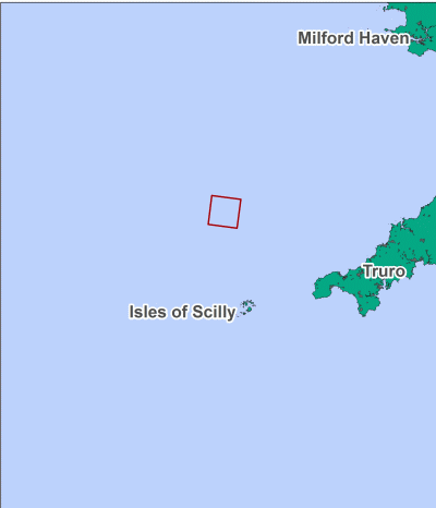
Contains UKHO Law of the Sea data. Crown copyright and database right and contains Ordnance Survey Data Crown copyright and database 2012
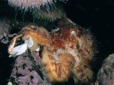
Octopus ©Paul Naylor www.marinephoto.co.uk
Padstow Bay and Surrounds
This site was designated a Marine Conservation Zone in 2013 in order to protect the rock and sediment habitats found within the site, as well as pink sea fans and spiny lobsters.
Stretching from the shore line to around 50m deep, this inshore Marine Conservation Zone includes a number of very different marine habitats, ranging from sandy bays to rocky shores to kelp forests.
Trevone and Trebetherick host the most extensive rocky shores on the north Cornwall coast. All manner of marine plants and animals live here, including algae grazing limpets, filter feeding mussels and barnacles. The rare Celtic sea slug has even been recorded at Trebetherick.
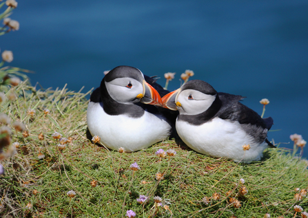
The Bull, near Trevose Head, offers a different marine community altogether; a kelp forest provides shelter for many species including fish and crustaceans such as the crawfish and European spider crab. Blue mussel beds are also found here. Bottlenose dolphins have been recorded using the area and Moule Island, off the Rumps, is home to the largest nesting colony of puffins in Cornwall.
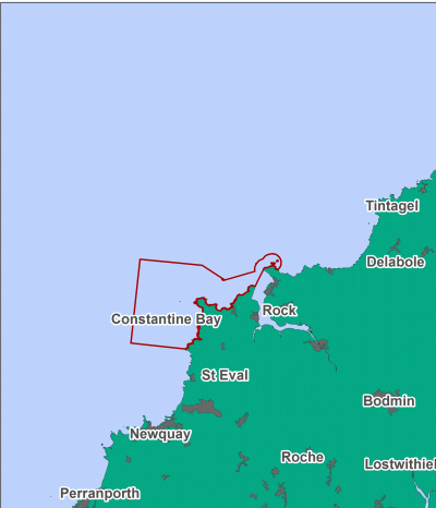
Contains UKHO Law of the Sea data. Crown copyright and database right and contains Ordnance Survey Data Crown copyright and database 2012
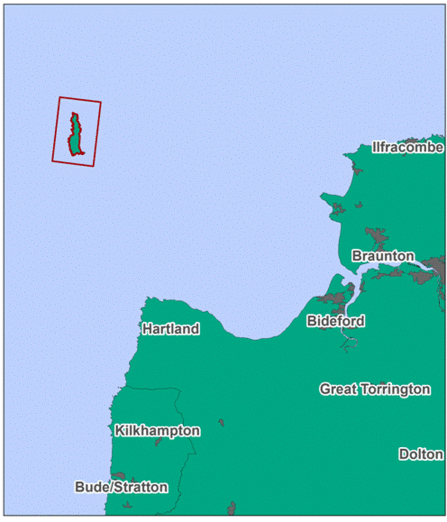
Lundy
The deep waters around Lundy Island are home to some of the most spectacular and diverse marine life in the UK. This site was designated as a Marine Conservation Zones in 2013 to protect the spiny lobster found here, supporting the protection provided for other habtiats and species by Lundy's designation as a Special Area of Conservation.
Lundy Island sits in the Bristol Channel at a place where cold currents from the north meet warmer ones from the south. This creates the ideal conditions for marine life. In 1986 Lundy became a Marine Nature Reserve. Protected since its designation, the recovery of marine life in the years since has been spectacular.
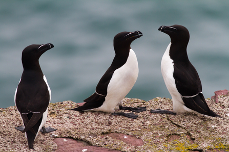
Today the sea around Lundy is home to anemones, sea fans, sponges and corals. The chocolate finger sponge is just one of many sponges which thrive around the coast of Lundy. 300 species of seaweed cover its reefs and inshore rocks, while seabirds including Manx shearwaters, guillemots and razorbills take advantage of its rich fish stocks.
Contains UKHO Law of the Sea data. Crown copyright and database right and contains Ordnance Survey Data Crown copyright and database 2012
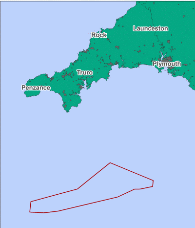
Western Channel
Western Channel is located 54km south-east of the Lizard Peninsula and its southern boundary follows the UK continental shelf limit.
A mosaic of habitats are included within this MCZ, including coarse sediment, mixed sediment and moderate energy rock. These habitats support many benthic species, animals that live on the seafloor such as polychaete worms, bivalve molluscs and echinoderms.
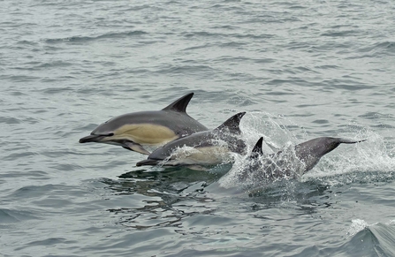
Productive frontal systems are found in the Western Channel. These frontal systems carry an abundance of fresh food from cooler deeper waters into the sunlit surface waters where plankton can flourish. This feature acts as a catalyst for marine life and brings together many marine animals to feed including seabirds and cetaceans, such as the short-beaked common dolphin.
Contains UKHO Law of the Sea data. Crown copyright and database right and contains Ordnance Survey Data Crown copyright and database 2012
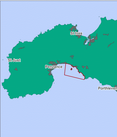
Mounts Bay
Mounts Bay MCZ stretches from the eastern side of the bay to encompass St Michael's Mount and the Marazion area.
A range of habitats can be found here but the most dominant is high energy rock and sand. This high energy environment is home to several important species such as seagrass, stalked jellyfish and crayfish, as well as being a well recognised area for dolphins, porpoises and basking sharks.
The area is adjacent to Newlyn: one of the country's largest fishing ports and home to many fishermen, who have been consulted on the positioning of this site.
Contains UKHO Law of the Sea data. Crown copyright and database right and contains Ordnance Survey Data Crown copyright and database 2012
Land's End
Land's End is in one of the South-West’s most recognised areas and is renowned for its rugged coastline.
This MCZ off Gwennap Head is an outstanding area subject to large tidal and wave energy. Rare species, like the pink sea fan, colonise the rocky reef, and tidal currents and high productivity attract large marine life such as whales, dolphins and basking sharks.
This site is one of the UK's best spots for critically endangered Balearic shearwaters, which visit and feed in the area and is also important for a number of whale, dolphin and porpoise species that are often spotted here.
Contains UKHO Law of the Sea data. Crown copyright and database right and contains Ordnance Survey Data Crown copyright and database 2012
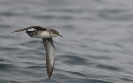
Balearic shearwater ©Chris Gomersall/2020VISION
North-West of Jones Bank
North-West of Jones Bank is located 165km west of Land's End and supports important habitats, such as subtidal mud, which is indicative of these stable offshore areas where fine particles are able to settle. Mud is a particularly important habitat for a variety of marine species, including polychaete worms and brittlestars that in turn support the marine food web
This area is known to be an important foraging ground for seabirds during winter. Diving birds in particular will migrate to the sea during winter, including internationally important Great northern divers that move offshore from August until the early spring, when they move back to their largely Icelandic breeding grounds.
You can see a video of this MCZ produced by the JNCC here.
Contains UKHO Law of the Sea data. Crown copyright and database right and contains Ordnance Survey Data Crown copyright and database 2012
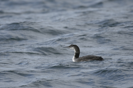
Great northern diver ©Chris Gomersall/2020VISION
Greater Haig Fras
Greater Haig Fras is an isolated area 95km north-west of the Isles of Scilly in the Celtic Sea. The area is particularly significant as it encompasses all of the Haig Fras, a geologically valuable, fully submersed outcrop of bedrock.
A range of important sediment habitats surround the Haig Fras. Partially embedded boulders and cobbles provide complex habitats for important marine species to shelter within and find food.
The Haig Fras rock complex is the only substantial area of rocky reef in the Celtic Sea beyond the coastal margin, and supports a mosaic of plants and animals, including fantastic jewel anemones, Devonshire cup corals and encrusting sponges.
You can see a video of this MCZ produced by the JNCC here.
Contains UKHO Law of the Sea data. Crown copyright and database right and contains Ordnance Survey Data Crown copyright and database 2012
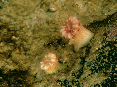
Devonshire cup coral ©Paul Naylor www.marinephoto.co.uk
Newquay and the Gannel
This area encompasses a number of different habitats, which includes intertidal rocky habitats, both fine and coarse intertidal sediment, coastal saltmarsh, and saline reedbeds as well as subtidal habitats ranging from sands and gravels to rocky reef.
This wealth of habitats supports several important species such as the protected pink sea fan, crayfish and European eel. Other commercially important species include sandeels, which can be seen using the sand and gravel to avoid predators, and salmon, which migrate up the estuary to breed.
Contains UKHO Law of the Sea data. Crown copyright and database right and contains Ordnance Survey Data Crown copyright and database 2012
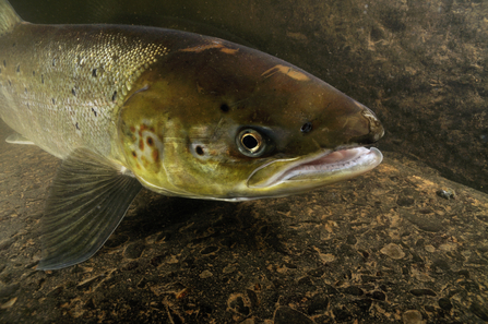
Atlantic salmon ©Linda Pitkin/2020VISION
Hartland Point to Tintagel
The Hartland Point to Tintagel MCZ has a higher than average species and habitat diversity.
Characterised by steep rocky cliffs, sea caves and stretches of sandy surf beaches, this coast is exposed to high levels of wave energy and is potentially important for cetaceans and sharks, especially porbeagle sharks. The area extends from the shore line to depths of approximately 50 meters.
Near to the shore, gently sloping bedrock is dominated by a number of notable algae and kelp forest species. Lower shore habitats have exceptionally fine colonies of the reef-building honeycomb worms. Mussel beds are extensive in the northern half of the bay. In deeper waters, vertical and upward facing underwater rock is dominated by bryozoans, sea squirts and sponges.
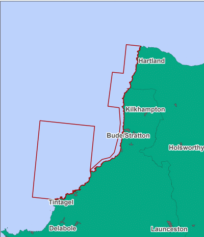
Contains UKHO Law of the Sea data. Crown copyright and database right and contains Ordnance Survey Data Crown copyright and database 2012
Bideford to Foreland Point
This stretch of coastline has a long and diverse list of interesting and scarce species. It is characterised by cliffs and rocky shores, small sandy bays and inlets with an expanse of sandy shoreline at Bideford Bay.
Notable species here include the native oyster, peacock’s tail seaweed, Celtic sea slug and European eel. Reef builders include the ross worm and honeycomb worm.
Additional rare, scarce and sensitive species present are the pink sea fan, scarlet and gold star coral, Weymouth carpet coral, policeman anemone, Devonshire cup coral, stalked jellyfish and short-snouted seahorse. Fragile subtidal sponge and anthozoan communities are present, and the area is also important for seabirds and cetaceans, with harbour porpoises visible from headlands along the coast.
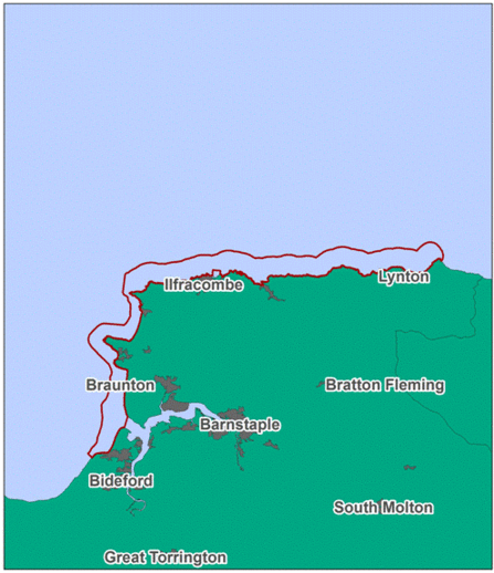
Contains UKHO Law of the Sea data. Crown copyright and database right and contains Ordnance Survey Data Crown copyright and database 2012
North West of Lundy (newly designated)
This site was recommended as an alternative to the North of Lundy co-location zone. Like the original, this alternative site will protect subtidal coarse sediment - as well as the fantastic array of life that it supports, including burrowing worms, clams and anemones.
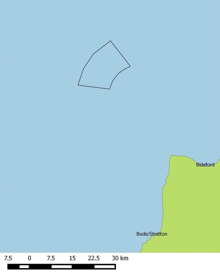
Contains UKHO Law of the Sea data. Crown copyright and database right and contains Ordnance Survey Data Crown copyright and database 2012
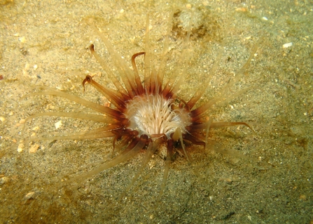
Burrowing anemone ©Polly Whyte/Earth In Focus
Morte Platform (newly designated)
The Morte Platform is an area of rocky outcrops with patches of sediment, approximately 5km off Baggy Point in North Devon. The depth of the area ranges between 35 and 40 metres below sea level.
This site represents an area of higher than average species diversity within the south west context, due to the ridged and varied nature of the seabed. It includes rich communities of subtidal living reefs including ross worm reefs and mussel beds, which provide shelter for other marine species. The mix of biotopes represented here is rarely found anywhere else in the UK.
This site has a higher than average seabed diversity and a mixture of habitats rarely seen due to the unusual physical conditions of the site. The site is supported by the Devon local group and was agreed within a cross-sector stakeholder meeting which included representatives from the fishing industry and the renewable energy sector.
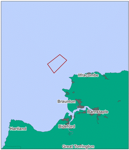
Contains UKHO Law of the Sea data. Crown copyright and database right and contains Ordnance Survey Data Crown copyright and database 2012
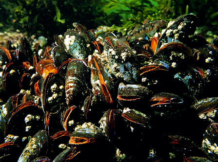
Mussels ©Paul Naylor www.marinephoto.co.uk
Camel Estuary (newly designated)
The Camel Estuary is a well know area of biodiversity and productivity and the recommended MCZ aims to protect this fantastic estuarine habitat. This estuary is of specific importance as it includes habitats which range from high energy intertidal rock zones to low energy mud and saltmash habitats.
This diversity of habitats supports a huge range of species but also includes several protected species, such as the European eel. Many wading birds and cetaceans also visit the area.
This site provides connectivity with other estuarine sites within the region; ensuring that our MPA network is ecologically coherent and providing the best possible protection to our marine environment.
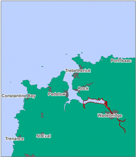
Contains UKHO Law of the Sea data. Crown copyright and database right and contains Ordnance Survey Data Crown copyright and database 2012
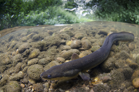
Eel ©Jack Perks
Devon Avon Estuary (newly designated)
The Devon Avon Estuary is a small estuary reaching approximately 4km inland from the coast up to Aveton Gifford. The estuary mouth is coarse sediment with a scoured channel and semi-exposed rock platfoms, supporting characteristic crustacean and polychaete communities.
The lower estuary is made up of a mixture of different grades of sand, from coarse to fine. Various species of worm, crustacean and shrimp can be found here. One specimen of the rare tentacled lagoon worm has been recorded living in the thick, deep mud.
Like most estuaries of the South-West, the Devon Avon is an important nursery area for fish species and is potentially important for seahorse populations as it provides suitable food and shelter. The site also provides important sediment habitats including saltmarshes, which provide nursery habitat for crustaceans, molluscs and juvenile fish as well as feeding grounds for birds.
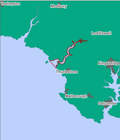
Contains UKHO Law of the Sea data. Crown copyright and database right and contains Ordnance Survey Data Crown copyright and database 2012
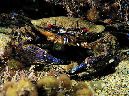
Velvet swimming crab ©Paul Naylor
South of the Isles of Scilly (newly designated)
15km south of the Isles of Scilly, this MCZ is of particular importance due to the subtidal sand and coarse sediment habitats. The area improves the connectivity for these sediment habitats and the marine species that rely upon them, including the commercially important monkfish.
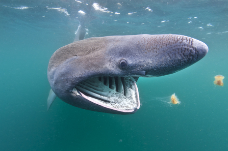
This site is extremely important for marine wildlife due to a relatively high occurrence of thermal fronts that are highly productive and support rich supplies of plankton. The second largest fish in the world, the basking shark, is occasionally spotted here throughout the summer months, when they migrate inshore from the continental shelf to filter feed on the large number of copepods gathered along frontal systems.
This site has also been associated with important nursery and spawning sites for marine fish and is an important area for seabirds.
South of the Isles of Scilly has been identified as being at risk by Natural England and the Joint Nature Conservation Committee.
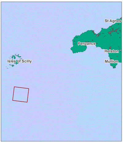
Contains UKHO Law of the Sea data. Crown copyright and database right and contains Ordnance Survey Data Crown copyright and database 2012
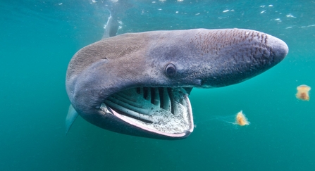
A basking shark (Ceterhinus maximus) feeds on plankton concentrated in surface waters close to the island of Coll, Inner Hebrides. Scotland, UK. North East Atlantic Ocean. Photographed in June 2011. - Alexander Mustard/2020VISION
Cape Bank (newly designated)
West of the Land's End peninsular lies the Cape Bank MCZ. Diverse species of marine life are at home on the fully submerged granite reefs, including many sponges and algal communities.
A large, sweeping, crescent shaped reef is included within the area. Extending to 12km at its widest part and around 35km in length, the reef is a feature of conservation importance.
Many species live here including crawfish, which use the nooks and crannies for shelter, filter feeding bryozoans, reliant on the tidal surges bringing a fresh supply of food, and the Devonshire cup coral, which is often mistaken for an anemone due to its similar appearance but is actually a species of coral.
This site was designated as it was identified as being at risk from damage and deterioration by Natural England and the Joint Nature Conservation Committee due to the presence of sensitive features and high pressures within the site.
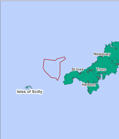
Contains UKHO Law of the Sea data. Crown copyright and database right and contains Ordnance Survey Data Crown copyright and database 2012
South-West Deeps (East) (newly designated)
The eastern boundary of South West Deeps (East) is located approximately 170km off Land's End and the southern boundary aligns with the UK continental shelf limit. Within the boundaries the geologically important Celtic Sea relict sand banks are present, which are a historic feature of the seabed and marine environment.
This area is important for a range of seabed habitats that support the marine ecosystem, including mixed sediments and sand. These habitats provide burrowing opportunities for important prey items, such as worms, and camouflage for many species of fish to hide from predators.
A section of the continental shelf break is also found within the South-West Deeps (East), increasing the range of depths and ultimately the biodiversity of species living and visiting this area.

Contains UKHO Law of the Sea data. Crown copyright and database right and contains Ordnance Survey Data Crown copyright and database 2012
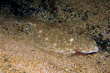
Plaice ©Paul Naylor www.marinephoto.co.uk
North-East of Haig Fras (newly designated)
This area is found about 100km to the north-west of Land's End, in the Celtic Sea. The northern boundaries of this MCZ are aligned with the continental shelf limit of the UK. It was chosen for the subtidal sand, subtidal mud and coarse sediment habitats that are found in this area, with depths ranging from 50 to over 100 metres.
Mats of delicate sea anemones are found here, and the shallower parts support populations of the hermit crab Pagarus prideaux. This crab often shares its shell with cloak anemones, a symbiotic relationship that's beneficial to both the crab and the anemone. The crab benefits from protection from the stinging cells of the anemone, and the anemone benefits from food stirred up during the crab's foraging.
This site contains a number of habitats which are considered to be ecologically important at a regional scale, as only a small proportion of these habitats are protected within existing MPAs in the region. Furthermore, the site contains nursery and spawning areas for fish and potentially provides important habitat for seabirds.
Contains UKHO Law of the Sea data. Crown copyright and database right and contains Ordnance Survey Data Crown copyright and database 2012
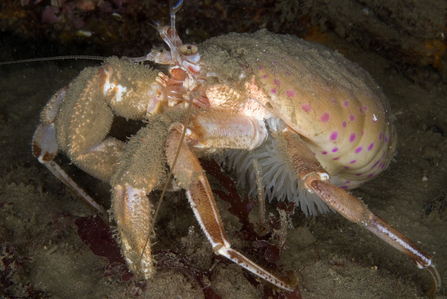
Cloak anemone on hermit crab ©Paul Naylor www.marinephoto.co.uk
Erme Estuary (newly designated)
The Erme is a narrow, sheltered estuary approximately 6.5km long. Bound by dense woodland, this drowned river valley (or ria) is remote and unspolit. Mixed habitats abound in this small estuary, from sandy seabed to areas of exposed bedrock. The shoreline is similarly varied, from shingle and cobble habitats to the beautiful sands of Wonwell beach.
The estuary is designated as a ‘Several Fishery’ and has managed bait and shellfish collecting. Like other estuaries in the south-west, it is important for its function as a nursery area for fish species, with sea trout also using the area for spawning.
The rocky habitats within this site provide habitat for commercially important species including lobster and crab and the subtidal sediment provides important nursery habitat for many fish species and feeding grounds for wading birds.
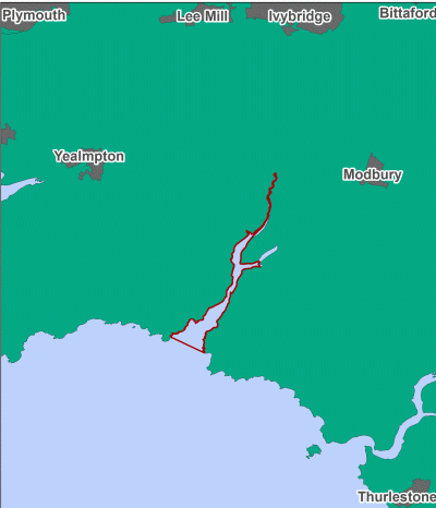
Contains UKHO Law of the Sea data. Crown copyright and database right and contains Ordnance Survey Data Crown copyright and database 2012
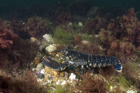
Lobster ©Paul Naylor www.marinephoto.co.uk
Helford Estuary (newly designated)
This inshore MCZ on the southern coastline of west Cornwall would cover 6 km2. The current boundaries of the Fal and Helford Special Area of Conservation (SAC) in the estuary are set at mean low water, while this MCZ’s boundaries are set at mean high water, protecting the intertidal habitat crucial for the key feature of this site: native oysters.
The Helford ria system (drowned river valley) contains a significant range of fully marine habitats thanks to low freshwater input. Habitats here are highly influenced by exposure, ranging from sheltered mudflats to exposed rocky coast that support huge species diversity across the site.
Intertidal sandflats and mudflats make up the majority of the Helford’s shores, and these are recognised for their important sediment-dwelling inhabitants, including invertebrate and bird communities. Native oysters, an Oslo and Paris Convention for the Protection of the North East Atlantic threatened and/or declining (OSPAR) and Biodiversity Action Plan (BAP) priority species are among these. Found in shallow water on mixed sediments, oysters filter huge amounts of water, provide a solid surface for other species to settle on in an otherwise unstable habitat, and offer some protection and nursery grounds for other species, including small fish.
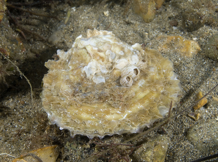
Oyster ©Paul Naylor
South-West Approaches to Bristol Channel (newly designated)
This large site covers an area of approximately 1,128 km2 off the northern coast of Cornwall. Primarily offshore, the edge overlaps a portion of the 12 nm boundary into the inshore area, and the site’s eastern half overlaps with the Bristol Channel Approaches Special Area of Conservation (SAC).
This MCZ protects a range of subtidal sand and coarse sediment that is home to species including sea urchins, worms, razor shells, and sea cucumbers. Additionally, as this site spans the inshore/offshore boundary, it improves the connectivity between inshore and offshore sites protecting this type of habitat.
Razor shell ©Tom Hibbert
South of Celtic Deep (newly designated)
Located off the north coast of Cornwall, this MCZ covers an area of 278 km2; its south-eastern tip falling 90 km to the north west of the Land’s End peninsula, and its western boundary aligned with the limit of English territorial waters. These boundaries have been revised since its original proposal to exclude offshore waters adjacent to Wales, which are now regarded as the responsibility of the Welsh government.
With depths ranging between 50-100 m, dipping below 100 m in two small areas, light reaching the seabed is limited, which restricts plant life and results in a seabed dominated by animal communities.
The varied seabed here is composed of subtidal sand, coarse, and mixed sediments, as well as slightly sheltered deep water rocks (moderate energy circalittoral rock), supporting an assortment of animals including starfish, anemones, sea urchins, bivalves (animals with paired, hinged shells), worms, and sea firs (colonial animals resembling trees).
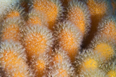
Dead man's fingers ©Alex Mustard/2020VISION

