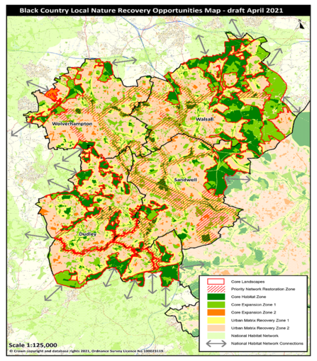
The Environment Bill requires a Local Habitat Map that identifies the existing distribution of different habitat types in a region, and the location of areas already important for biodiversity. These maps reveal locations considered suitable for delivering the outcomes and measures identified in the Government's “Statement of Biodiversity Priorities”.
The draft Black Country Local Nature Recovery Opportunities Map has been produced by the Wildlife Trust for Birmingham and the Black Country and the Local Environmental Records Centre (EcoRecord), through analysis of local and national data sets including designated sites, priority habitats, species distribution, land use and ecological connectivity. The map comprises a number of components which depict the areas of current high ecological value, ecological connectivity between these areas, and prioritises opportunities for investment in nature’s recovery on a landscape scale. The map and component descriptions have been published and referred to in the policies of the Draft Black Country Plan, July 2021.

Draft Black Country Local Nature Recovery Opportunities Map

