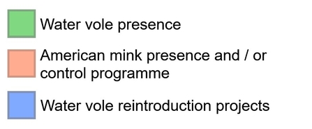
The National Water Vole Database Project (NWVDP) is the only project of its kind in the UK. By bringing together and mapping water vole and mink data, we can inform conservation efforts to give ratty the best possible chance.
Led by The Wildlife Trusts and delivered by Hampshire & Isle of Wight Wildlife Trust, the project was established in 2008 by the UK Water Vole Steering Group as a way to collate water vole survey records, map the distribution of this species and identify important areas for water vole conservation. The project also collates and maps data on the American mink. The project was previously known as the National Water Vole Database and Mapping Project.
Our latest report and maps, published in 2024, show we can - and have - halted the decline of water voles in key areas. However, their current distribution remains just a fraction of what it was 60 years ago, and overall range continues to contract. Calculations in the 2024 report estimate the UK population of water voles to be between 58,341 and 186,142 individuals. .
Water voles still urgently need our help.
Our changing understanding of the status of water vole highlights how important is it to continue to monitor water vole populations, so that conservation efforts can be informed by up-to-date data. The Wildlife Trusts believe that the maps produced through the NWVDP can inform a more strategic approach to the conservation of water vole. They should, for example, be used in ecological network mapping to inform local plans, such as through the Nature Recovery Network approach.

Get involved
The success of the National Water Vole Database Project depends upon collaborative work with the Local Environmental Records Centres, Wildlife Trusts, museums and other organisations who do a tremendous job to provide us with all the records they have received and verified over the course of the year.
The data suppliers, in turn, depend upon keen amateur and professional surveyors who freely supply their records to help complete the picture of how the UK’s wildlife is faring.
This is where you can get involved! There are a number of ways you can take part and help build our understanding of water vole and mink distribution across the UK:
- Sign up to online recording - such as iRecord, Living Record and Mammal Mapper
- Submit a one-off record – get in touch with your Local Environmental Records Centre or Wildlife Trust
- Take part in a survey - Check out your local Wildlife Trust for details of volunteer surveyor opportunities, or take part in the National Water Vole Monitoring Programme run by the People’s Trust for Endangered Species
The maps in action
We are always thrilled to hear how the National Water Vole Database Project is being used to help further water vole conservation. Here are just a few examples of how conservationists have been using the project's outputs.
Graham Holyoak, Northumberland Wildlife Trust – Following the success of the Restoring Ratty project, “the National Water Vole Database Project has allowed us to look further afield as we look at the next stage of the [Restoring Ratty] project and our goal of connecting the new Kielder population with its donor population in the North Pennines.”
Darren Tansley, Essex Wildlife Trust – “The results of the ten-year review by the National Water Vole Database Project have been a key part of informing [our] regional [mink eradication] pilot, attracting funding and identifying the necessity to move from open-ended, potentially patchy mink control, to properly funded eradication. The NWVDP will provide the ideal opportunity to compare the eradication zone with similar areas where mink control is absent or small scale and assess the impact for water vole conservation.”
Julia Lofthouse, Mammal Project Officer, Beds, Bucks & Oxon Wildlife Trust - “Your data is especially useful when looking at sites beyond our county…By seeing that our Regional Key Area on the Upper Thames and River Cole extends over the county boundary into Gloucestershire and incorporates some of Gloucestershire Wildlife Trust’s known water vole sites; I know to talk to GWT to link our mink control schemes up.”
Elaina Whittaker-Slark, Lead Ranger (Western Downs), South Downs National Park Authority - “We are planning a Rivers for Life project within the SDNPA and the alert maps have been useful in prioritising areas within the national park area, where there are mink and/or water voles. Having access to these maps and the ability to request variations on them will assist us in contributing to the conservation of water voles within the NP. Baseline data, especially shown in maps, is important when planning any future projects and reference for those ones that have been completed.”
The small print
River Catchments
The maps are divided by broad River Basin Districts which are published by the Environment Agency under an Open Government Licence.
Copyright information
The PDF maps are free to download, but please credit the National Water Vole Database Project in any published material arising from your use of the maps. The report should be cited as:
Glossop, A. and Morse, A, (2024) National Water Vole Database, PART 1: Project Report 2013 – 2022. Hampshire and Isle of Wight Wildlife Trust. Curdridge
Acknowledgements
This update to the National Water Vole Database Project has been made possible by funding from Natural England.
The People’s Trust for Endangered Species, Environment Agency, Natural Resources Wales and NatureScot have also previously provided funding to support this project.
A note on the use of the maps
The alert maps are intended to inform the design and implementation of conservation programmes and other works and site management, including habitat enhancements, river rehabilitation, restoration projects and routine works, undertaken in or adjacent to important water vole sites. They can also be used in research on the ecology and conservation of water voles and management of American mink.
We’re always keen to understand how the maps are helping in water vole conservation. So whether you’re a student carrying out a research project, a local authority planner, a landowner carrying out habitat enhancement work or a local interest group working to protect a river in your area, we want to hear from you – please email us.

