Government’s planning reforms must address the nature and climate crisis

Government’s planning reforms must address the nature and climate crisis

The Wildlife Trusts call for a new designation – Wildbelt – to allow nature’s recovery

Public urged to rewild planning system by responding to consultation

New analysis of the Government’s White Paper, Planning for the Future, has revealed that, as they currently stand, the proposed reforms will increase the threat to nature in England and do little to create better homes and communities for wildlife and people.

Based on their analysis, The Wildlife Trusts are calling on the Government to commit to five principles to be applied to future planning which would ensure the reforms can address the climate and ecological crises and people’s need for nature around them. One of these principles would, for the first time, protect new land put into nature’s recovery. For this, The Wildlife Trusts propose a new protection mechanism called Wildbelt.

Craig Bennett, chief executive of The Wildlife Trusts, says:

“We’re in a climate and ecological crisis and we cannot afford to lose any more wildlife – we need a new Project Speed for nature. We must keep the environmental protections that we have – but even that is not enough. Protections must be strengthened, and the Government needs to take a big step towards helping nature to recover everywhere. The new planning reforms currently propose an algorithm-based system that’s dependent on non-existent data. That’s a system that will fail nature and lead to more loss.

“Evidence shows that healthy communities need nature and the government must map out a Nature Recovery Network across every one of their proposed zones, whether it’s a growth, renewal or protected area. We’re proposing five principles to ensure the planning system helps nature and we want to see a bold new designation which will protect new land that’s put into recovery - we’re calling this Wildbelt.”

The Wildlife Trusts’ five principles are

1. Wildlife recovery and people’s easy access to nature must be put at the heart of planning reform by mapping a Nature Recovery Network 

2. Nature protection policies and standards must not be weakened, and assessment of environmental impact must take place before development is permitted

3. Address the ecological and climate crises by protecting new land put into recovery by creating a new designation - Wildbelt

4. People and local stakeholders must be able to engage with the planning system

5. Decisions must be based on up-to-date and accurate nature data

The UK is one of the most nature-depleted countries on the planet and the government has committed to reversing wildlife declines. A successful planning system is crucial to securing the recovery of nature and creating healthy communities with natural green space on people’s doorsteps, no matter how dense the housing. However, The Wildlife Trusts, who respond to thousands of planning applications every year and are taking part in the White Paper consultation, believe the new Government proposals will make a bad situation worse.

As the Planning White Paper proposals stand, The Wildlife Trusts’ key concerns are:

  • Failure to address the climate, ecological and health emergencies together
  • The new zones will not reverse nature’s decline nor integrate it into people’s lives
  • Inadequate nature data means that planners will make poor decisions about zones
  • The bias will be towards permitting new developments
  • Simplifying Environmental Impact Assessments will weaken environmental protections
  • Undermining the democratic process by reducing people’s opportunity to influence the planning process

Nature-friendly developments would not happen under the proposed reforms - case study: Cambourne in Cambridgeshire is a nature-rich development where green infrastructure was designed in from the outset. It brings nature to the doorsteps of residents with local stewardship and community engagement. A natural network of green corridors weave through the development and beyond into the surrounding landscape. It was mainly built on former agricultural land of low biodiversity value – the design of the development has made this site more biodiverse than it was before the development took place. Details about Cambourne – which would be unlikely to have been built in its current form under the new proposals – can be found below in the Editor’s Notes.

Rewild the planning system

The Wildlife Trusts will be responding to the Government consultation and are urging the public to rewild the planning system by responding too.

Have your say!
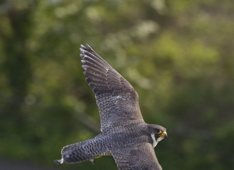
Peregrine falcon © Bertie Gregory 2020VISION

Peregrine falcon © Bertie Gregory 2020VISION

Read our initial analysis of the Planning White Paper

Read the full report

The Wildlife Trusts and planning

We work with national and local government, businesses and local communities to influence planning and development to achieve better outcomes for wildlife. The Wildlife Trusts respond to around 6,500 planning applications per year, and tens of thousands more are vetted and checked for impacts on wildlife. The Wildlife Trusts’ Homes for people and wildlife – how to build housing in a nature-friendly way can be read here.

The Wildlife Trusts’ five principles in more detail are:

  1. Wildlife recovery and people’s easy access to nature must be at the heart of planning reform. Strategic planning for nature, in which the network of space needed for nature’s recovery is identified, mapped and integrated into the planning system, must be applied across all zones. This Nature Recovery Network map must be upheld by law and should inform Local Plans.
     
  2. Nature protection policies and standards must not be weakened, and assessment of environmental impact must take place before development is permitted. Currently the reforms appear to suggest that in most cases this takes place after permission has been automatically given. 
     
  3. Address the ecological and climate crises by protecting land put into recovery. The Wildlife Trusts propose this be done by creating a new designation – Wildbelt – to support nature’s recovery. This would enable new land that is currently of low biodiversity value to be designated for nature, and so speed the creation of the Nature Recovery Network to which the Government is already committed. It must reach into every part of England, from rural areas to towns and cities, securing the future of the new land that we are putting into recovery so that we can reach at least 30% of land in recovery by 2030 and address the climate and biodiversity emergency. Wildbelt would form a central part of the National Planning Policy Framework review.
     
  4. People and local stakeholders must be able to engage with the planning system at points where it is meaningful to them and sufficient information is available to understand the impacts – on nature and on local communities. It is vital that communities are made aware in the consultations of all the issues and opportunities their community faces – including climate and ecological challenges 
     
  5. Decisions must be based on accurate nature data. A full program of investment is required to establish high quality ecological data. This will take time, so a transition program is needed to ensure that any fast turn over to new systems doesn’t destroy natural places in the process. As strategic data does not provide the site-level detail necessary to ensure nature is properly taken into account, ‘permission in principle’ in the zones should still be able to be revoked.  Timely, site-based survey work is crucial for accuracy and will recognise that nature changes and moves around.

As the Planning White Paper proposals currently stand, The Wildlife Trusts’ key concerns, in more detail, are:

  • New zones will not reverse nature’s decline nor integrate it into people’s lives.

Allocating all land to fall within one of three new proposed zones will jeopardise nature at every count and fail to integrate it into the places where people live, work, learn and play. Nature will be automatically ignored and built over in the Growth area, overwhelmed by denser development in the Renewal area and not actively helped in Protected areas where we know that wildlife is already struggling. Planning decisions should be informed by surveys of potential sites, not purely informed by zones.

  • Inadequate nature data means that planners will make poor decisions about zones leading to potentially catastrophic impacts for wildlife sites. The Wildlife Trusts do not believe it is possible to gather the level of data needed for these proposals.
  • The bias will be towards permitting new developments – and allowing much more of it. The proposals are driven by economic growth and building – and doing all this at speed rather than considered place-making. The government has committed to put the environment at the heart of planning and development, to create better places for people to live and work in its 25 Year Plan for the Environment. These proposals are failing in that ambition because development could go ahead even if it is later found to be seriously damaging to nature.
  • Simplifying Environmental Impact Assessments that are designed to save nature, where it still exists, will weaken environmental protections and threaten its ability to survive and recover. There is already, often, insufficient information on which to make reliable decisions and the proposals do not address this.  The cost of providing robust data over whole Local Authority areas is huge, which is why development decisions are currently informed by targeted survey.  Streamlining could reduce quality and mean impacts on nature are not fully assessed.
  • Undermining of the democratic process – the reforms provide less opportunity to influence individual development proposals. The zoning approach will mean decisions are made up-front leaving no option for communities to challenge harmful developments.
  • Failure to address the climate, ecological and health emergencies together – restoring and creating wild places across all zones would ensure carbon-storing habitats that help tackle climate change and provide access to nature to improve people’s lives.

Case study – Cambourne

The new settlement of Cambourne was conceived in the 1990s as a series of three interlinked villages and comprises 4,200 dwellings. The settlement’s design respected the existing landscape character, identifying existing habitat features and using them as the building blocks for the network of green spaces. The green spaces framed, joined and permeated each of the three villages - giving residents and wildlife easy access to the whole network. This consideration to design has made Cambourne a safe and attractive place where people want to live and engage with their local environment and where wildlife can thrive.

Green space makes up 60% of the settlement and includes pre-existing and new woodlands, meadows, lakes, amenity grasslands, playing fields, allotments and formal play areas. There are 12 miles of new footpaths, cycleways and bridleways and 10 miles of new hedgerows. The new grassland areas are rich in ground nesting birds such as skylarks and meadow pipits which have had great breeding success over the years. The lakes and ponds that serve to prevent flooding also provide great habitat for wildfowl and dragonflies.

Management of the green spaces is undertaken by the new Cambourne Parish Council and The Wildlife Trust for Bedfordshire, Cambridgeshire & Northamptonshire. The land will eventually be transferred to each of these organisations. Negotiations between The Wildlife Trust, developers and the local authorities secured an agreement that the Trust would manage the green spaces in return for office premises, initially rent free, with full ownership after ten years. Cambourne is nearing completion and The Trust continues to work closely with the developer until the official handover date.

“We like living in Cambourne because we have attractive and varied open spaces on our doorsteps with no need to get in the car.  The open spaces feel safe and the kids have both natural and formal play areas within walking distance of our home.  We like watching the ducks, swans and other birds down by the lakes. When I go for a run I like the fact that I can take a variety of circular routes through woodlands and meadows and I can see views of the open countryside, while the new planting hides much of the housing”.

If Cambourne was conceived under the new Planning White Paper proposals – what might the risks be?

  • The area for development would most likely be allocated to the Growth area and as such given outline planning permission in the local plan.
  • With no detail on the content of the design codes and no mention of a requirement for development in Growth areas to provide green infrastructure and nature-rich green spaces  – currently, there are obvious concerns that future developments would not be designed with people and nature in mind, like Cambourne.
  • With the risk of no site-specific surveys as proposed by the Planning White Paper, the value of pre-existing habitats may not have been recognised – risking loss to valuable wildlife features and the opportunity to use these as the foundations of newly created natural infrastructure.
  • There is a risk that the red lines of zoning could result in physical barriers that fragment the nature recovery network: preventing species movement and denying access to natural green space close to where people live, work and play – Cambourne could have been an impenetrable mass of bricks and concrete
  • Loss of incentive and policy drive to engage ecological experts with local knowledge to help inform the design.  And certainly, third-party opportunities to comment on the specifics of the development, through formal consultation would not have been there under the proposed reforms. This early relationship building resulted in a lasting legacy of natural environment stewardship by the Trust, the parish council and the local community.