Stretching down from the north-east coast of Scotland to Flamborough Head in Yorkshire, this region covers the waters of the Northern North Sea. There are 8 existing Marine Conservation Zones in this region.
Existing Marine Conservation Zones
There have been eight Marine Conservation Zones designated in the Northern North Sea so far, ranging from Runswick Bay on the Yorkshire coast to the enormous Swallow Sand almost 100km offshore.
Swallow Sand
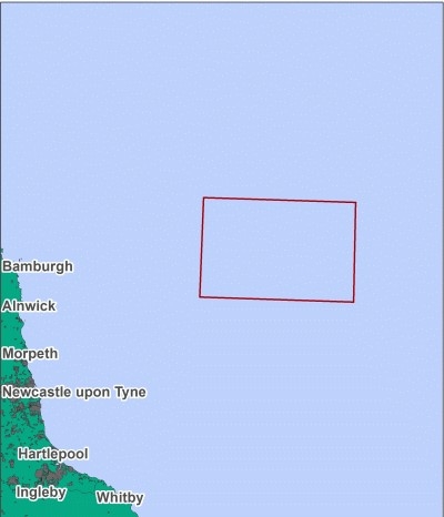
This site was designated in 2013 as a Marine Conservation Zone to protect the sediment habitats found in the area. Located within the northern North Sea, 99km off the Berwickshire coast, this site ranges from 50-150 metres in depth, making it one of the deepest areas in the North Sea. Swallow Sand is one of the largest MCZs, covering 4746.12km².
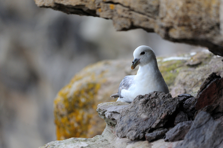
The seafloor consists of sand, coarse sediment, gravel and mud and is home to burrowing worms and bivalve molluscs. Within the western region of the site is an important geological feature, the Swallow Hole. This glacial tunnel valley supports high numbers of commercial fish species, including sprat and mackerel. The north-eastern region of Swallow Sand is an important area for summer foraging birds, including puffins, kittiwakes, guillemots, fulmars and gannets.
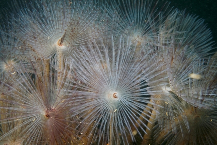
Peacock worms ©Peter Tinsley
North East of Farnes Deep
Originally called Rock Unique, this site has been renamed North East of Farnes Deep as additional survey work revealed that the rock habitats for which the site was named were not found, so the name was no longer thought appropriate.
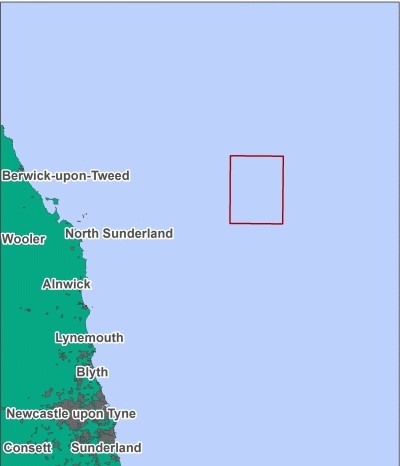
Located 55km offshore from the Berwickshire coast, the seafloor reaches 50 metres in depth and consists mostly of a mosaic of sand interspersed with gravel and coarse sediments. It was to protect these sand and gravel habitats that the site was designated in 2013.
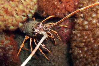
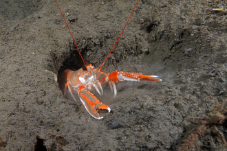
These habitats provide burrowing sediments for worms and bivales including the rare and incredibly long lived clam, the ocean quahog. Crustaceans can also be seen on the sediment surface including squat lobster.
Marine mammals are also spotted all year round, including white-beaked dolphins, harbour porpoises and minke and humpback whales, alongside foraging grey seals from the Farne Islands.
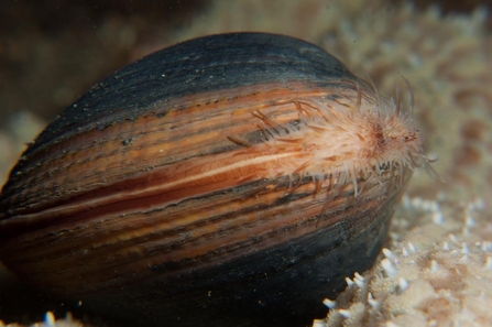
Ocean quahog ©arransealifeco.uk
Fulmar
Although 224 km off the Northumberland coast, with an area of 2,437 km2 this potential MCZ is one not to be forgotten about.
Fulmar is one of the deepest MCZs in the North Sea, reaching depths of between 50 – 100 metres. The seafloor is comprised of mud, sand and coarse mixed sediment providing habitat for a number of bivalves such as clams, cockles, ocean quahog and native oysters, as well as various species of worms and sea urchin. Mud is an important habitat and provides an ideal substrate for sea pens and burrowing anemones.
Protecting the seafloor habitats in turn helps to support mobile species such as seabirds and cetaceans. As the name suggests, this site is an important area for seabirds: black-headed gulls, fulmars, Arctic skuas, guillemots and kittiwakes all use this area.
Other notable species identified at the site are a benthic deep sea shrimp and the undulate ray, whose patterning makes for perfect camouflage against the surface of the mixed sediment seafloor.
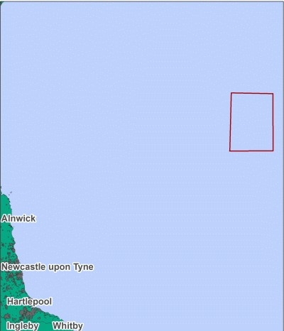
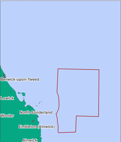
Farnes East
Located 11km off the Northumberland coast, within close proximity to the Farne Islands, Farnes East is made up of a range of habitats from rock and mixed coarse sediment to sand and peat and clay exposures. Depths range from 30 -100 metres, which results in animal communities dominating the site.
This site is important for mud, being one of the few MCZs in the North Sea to include this habitat. Mud is an important substrate and ideal for delicate blonde and red sea pens and burrowing animals like nephrops (langoustine) and ocean quahog. Ocean quahog is a large bivalve that can live up to 100 years and is an important food source for North Sea cod. The quahog buries itself in the mud, often completely, with just a tube sticking out the top of the mud for feeding and breathing.
To the south of the site the glacial channel known as the Farne Deeps is a highly productive area of upwelling where nutrient rich waters give rise to plankton blooms, attracting animal plankton and fish, which in turn attract large numbers of seabirds and cetaceans. Farnes East has been identified as being of particular importance for foraging and breeding white-beaked dolphins with regular sightings recorded.
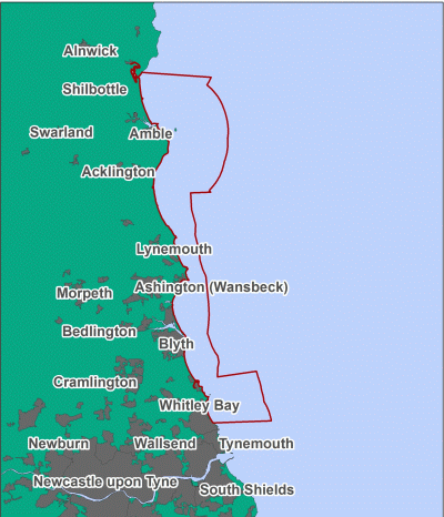
Coquet to St Mary's
Coquet to St Mary’s MCZ stretches from the high water mark down to depths of 30 metres, covering an area nearly 200km2, and is made up of a mosaic of different habitats, ranging from important mud, peat and clay and sand to both high and low energy rocky reefs and diverse under boulder communities.
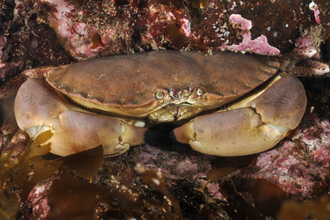
The under boulder species thrive in the in the damp shaded areas created, including different species of sponge, turfs of encrusting pink coralline seaweed and bryozoans like sea mats and horn wrack. These in turn provide excellent places for crustaceans like squat lobsters, porcelain and hermit crabs as well as edible crabs and lobsters to hide away in all the little crevices. In amongst all the plants you will find, sea urchins grazing on the wide variety of seaweed, different species of brittlestars clinging to the underside of rocks, sea slugs feeding on sponges and beadlet, strawberry and dahlia anemones. The first ever record of the Arctic cushion star on the English coast was found within the site!
Marine mammals are regular visitors to this site, benefiting from the diverse habitats; you can watch harbour porpoise, seals, white-beaked dolphins and even some species of whale. The site is also well known for its seabirds; Coquet Island is home to several thousand seabirds, and is particularly known for its puffins and terns including sandwich, Artic and common tern, which come to the island to breed. Coquet is also home to 90% of the UK’s Roseate tern population.
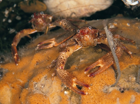
Squat lobsters ©Paul Naylor www.marinephoto.co.uk
Runswick Bay
Runswick Bay, located north-west of Whitby, boasts a highly productive seabed. The MCZ was recommended for 7 out of the 12 different seafloor habitats found here, including rock, sediment and gravel.
Shallow rocky areas here are dominated by kelps and red seaweeds, whereas deeper areas are encrusted in a living faunal turf of sponges, sea squirts, sea urchins and starfish. Interspersed with sand and gravel, this area is also important for burrowing creatures such as worms.
Runswick Bay also provides spawning and nursery grounds for many fish, including herring, sprat, cod, whiting and plaice. Harbour porpoises are regularly recorded here alongside foraging seabirds, such as kittiwakes.
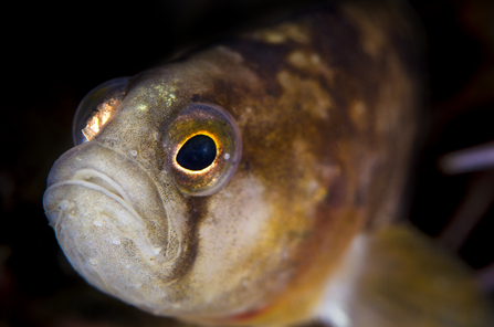
The shores of Runswick Bay are full of rockpools, providing habitat for a range of animals, including fish like rocklings, blennies and butterfish.
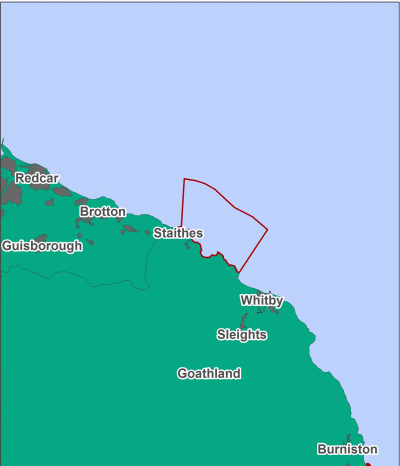
Aln Estuary
Located on the Northumberland coast, this estuary provides a link between the land and sea and is home to unique communities of life, making it of particular importance within the Marine Conservation Zone network.
This site was designated as a Marine Conservation Zone in 2013 to protect the estuarine habitats found here, including coastal saltmarshes, saline reedbeds and estuarine rocky habitats.
The Aln estuary site covers a range of habitats including mud, sand, gravel, sheltered muddy gravel, estuarine rocky habitats, saltmarsh and saline reedbed. It is one of the few places within the North Sea supporting seagrass and has significant importance for feeding and roosting birds, including gulls, dunlins and other waders such as redshanks, curlews, snipe and wigeons. Estuaries are also important for juvenile fish. The Aln supports sprat, flounder, sandeel, plaice and European eel.
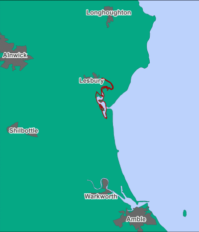
Contains UKHO Law of the Sea data. Crown copyright and database right and contains Ordnance Survey Data Crown copyright and database 2012
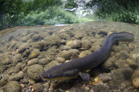
Eel ©Jack Perks
Berwick to St Mary's (newly designated)
Stretching along much of the Northumberland coast, from Berwick-upon-Tweed on the Scottish border to St Mary’s Island in the south, this MCZ helps protect common eider. It extends the existing Coquet to St Mary’s MCZ.
This MCZ includes the eider nesting grounds of the Farne Islands, which together with Coquet Island are the main breeding areas on the east coast of England. It is also important for eider outside of the breeding season, with 26.2% of the English (5.7% of the British) non-breeding population being found between Berwick-upon-Tweed and Coquet.
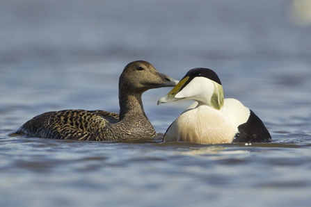
©Mark Hamblin/2020VISION

